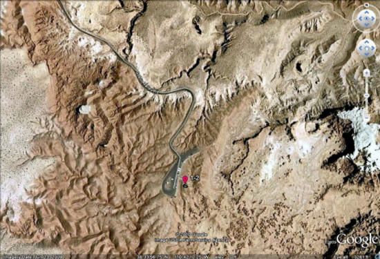
Day 1, Stop 2
Goblin Valley State Park
Jurassic Entrada “earthy facies” – Goblin Valley
Location:
24 miles south of I-70 on Highway 24
GPS Location:
38o 33.855' N
110o 42.184' W
Ages:
Late Jurassic (80 and 140 ma)
Rock Units:
“layer-cake” geology of several units (in descending order)
Morrison Formation
Summerville Formation
Curtis Formation
Entrada Sandstone (making up the “goblins”)
Features Present:
The Entrada Sandstone is made up of reddish-brown sandstones and mudstones comprising some of the typical redrock country of the Colorado Plateau, principally colored by the mineral hematite (an iron oxide and principal ore of iron). This formation lies between gray cliff-making rocks below and white massive beds above (Curtis Formation). The Entrada Sandstone is the same formation that erodes to arches, spires and hoodoos in Arches National Park (southeast Utah) and in Cathedral Valley in Capitol Reef National Park.
The dark red, fine-grained Entrada sandstone beds are generally less than a meter thick with some thin whispy white bands. The formation also includes thin sheets and small masses of gypsum, lenticular beds of gypsiferous shale, some calcareous shales, and small scattered red and green clay rip-up clasts.
The formation is up to 425 vertical feet of flat lying sandstones beds interpreted to be tidal flat deposits with some climbing ripples, and some mudstone rip-up lags. Some beds are remarkably massive. Sandstone beds typically form the cap of the goblins, underlain by softer horizontal layered pedestals of siltstone and mudstone.
The Entrada formation readily disintegrates from weathering and erosion. Joint or fracture patterns in the Entrada Sandstone create initial weak zones that are enlarged by weathering (e.g. spheroidal weathering) to created the round-shaped goblins.
Depositional Environment:
Sabkha, tidal, and nearshore ("earthy facies")


Figure 1: Climbing ripples in the Entrada Sandstone (climbing to the right) are overlain by parallel, flat lamination. These structures imply high sedimentation rates, and relatively high energy typical of a beach setting (parallel lamination where Froude number = 1).

Figure 2: Higher energy pulse of coarser-grained sand cut into finer-grained mud to produce the preserved mudstone rip-up clasts incorporated into the channelized sandstone.

Figure 3: Entrada goblins and hoodoos from the main parking lot on the right side of the road just past the entrance to Goblin Valley State Park. Wild Horse Butte, in the background, exposes all four rock formations (The Morrison, Summerville, and Curtis Formations, and the Entrada Sandstone).
